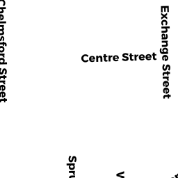
173-175 WILLOW ST
Owner Information
PICHARDO ELVIS
173 WILLOW ST APT 2
LAWRENCE, MA 01841


Property Details
173-175 WILLOW ST is classified as a Two-Family Residential (Family conver.).
The primary structure on this property was built in 1900. There are 3,759ft2 of built area within this property. There is 2,006ft2 of residential/living space within this property. This property is listed as having 10 rooms.
173-175 WILLOW ST is valued at $336,000. The land is valued at $93,200 and the structures are valued at $242,800.
This property is in Zone R-3. Confirm with local Zoning Board authorities to ensure there are no overlays or other easements on this property.
The most recent deed for 173-175 WILLOW ST is recorded at the local registrar in Book 13904, Page 178. 173-175 WILLOW ST was last sold on Monday, July 7, 2014 for $100.
Assessment data from fiscal year 2022.
Flood Data
According to the FEMA National Flood Hazard Layer, this property does not appear to be in a flood zone. It may also be in an area not yet reviewed. Nonetheless, confirm this information prior to taking any action.
To view the flood hazards around this property, create a FEMA "Firmette" Map of the area around 173-175 WILLOW ST.
Broadband Internet Providers
| Provider | Type | Bandwidth (mbps) | |
|---|---|---|---|
| VSAT Systems, LLC. | Satellite | 2 | 1 |
| HughesNet | Satellite | 25 | 3 |
| GCI Communication Corp. | Satellite | 0 | 0 |
| Comcast | Cable | 1000 | 35 |
| Verizon New England Inc. | Fiber | 940 | 880 |
| Verizon New England Inc. | DSL | 7 | 0 |
| Viasat Inc | Satellite | 100 | 3 |
Broadband service provider data from December 2020.
Adjacent Properties
- 146-148 EXCHANGE ST
Two-Family Residential owned by JIMENEZ ANGEL J/T - 150-152 EXCHANGE ST
Three-Family Residential owned by DOMINGUEZ CEFERINA L T/E - 154 EXCHANGE ST
Three-Family Residential owned by AVILA RUBIA - 48-50 CENTRE ST
Two-Family Residential owned by DE JESUS SANCHEZ MARINA - 171 WILLOW ST
Three-Family Residential owned by GONZALEZ JOSE O J/T